


Ever wondered whether Oliver Cromwell stole your family’s land in Ireland? Well, it's actually possible to find out.
That's because an amazing collection of maps unearthed by Trinity College Dublin (TCD) in recent years reveals the exact ownership of the lands plundered by the 17th-century English dictator.
Cromwell arrived in Ireland on August 13, 1649 at the start of the so-called Cromwellian 'Conquest' of Ireland – which resulted in the deaths and forced deportations of hundreds of thousands of Irish people.
The Down Survey – reproduced by TCD in 2013 – maps out in amazing detail the dramatic transfer in landownership from Catholic to Protestant landlords, many of whose ancestors still own vast swathes of Irish property today.
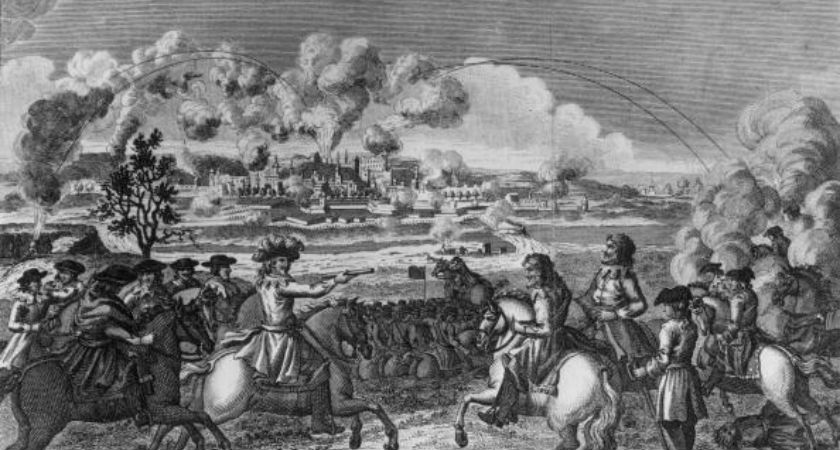 The Siege of Drogheda (1649) by Cromwell resulted in a huge massacre of civilians (Image: Hulton Archive/Getty)
The survey, undertaken by the Cromwellian regime in the years 1656-1658, introduced modern mapping techniques to Ireland and resulted in the first recognisable maps of the country.
It was also the first ever detailed land survey on a national scale anywhere in the world and measured all the estates to be "forfeited" by Catholic landowners.
More than 2,000 maps from the survey have been traced to libraries and archives in Dublin, London, Edinburgh, Paris, and Rome.
Many of them have been digitised and loaded onto GoogleMaps to give a complete picture of the lands stolen from Irish Catholics by Cromwell.
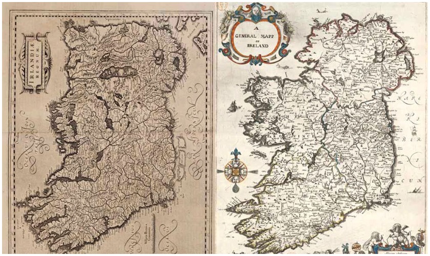 Down Survey map of Ireland (r) compared to a far less accurate map from 100 years prior (Image: TCD)
"We have never been able to do it to this level before – parish by parish, barony by barony, county by county," said Head of History at TCD, Professor Micheál Ó Siochrú, when the collection launched in 2013.
"If you are going to redistribute lands, then the first thing you have to do is map it and that is what happened.
“So the land survey – the first of its kind in the world – was carried out on Cromwell’s orders. The results are amazingly accurate for the time.”
The collection – the originals of which were destroyed in two fires in 1711 and 1922 – comprises county, barony and parish maps.
The maps are rich in detail – showing not only townland boundaries, but also churches, roads, rivers, bogs, woods and settlements.
Key features of TCD's Down Survey website include:
- 2,000 county, barony and parish maps from the Down Survey
- National, provincial and county maps detailing massive landownership transfer
- Mapping out of murders and violent assaults reported during the 1641 rebellion
- Representation of 17th-century road network
- A searchable database of over 10,000 landowners.
Prof Ó Siochrú added: “With the aid of ‘Books of Survey and Distribution’ which categorized the huge transfer of land from Catholic families to the new Protestant ascendancy, the result is that people all over Ireland will be able to research the ownership of lands in townlands going back to that time.
“From a historical point of view, it is mind-boggling. We have been left amazed at the scope of the project.
“People will be able to look at their own parishes and see where people were living in the 17th century – we have used it for two months in classes and it was a great hit with students – they all wanted to look up areas they came from or parts of the country they knew.”
