


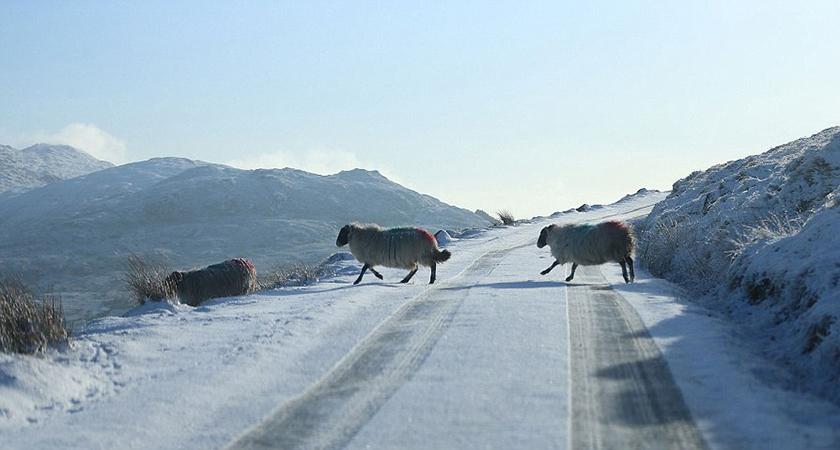
MET EIREANN'S Status Yellow weather warning will remain in place for the second day in a row this morning.
Ice and snow warnings have been issued with conditions set to turn sub-zero later this evening.
The alert was initially issued at 9am on Sunday morning and is due to stretch into much of Monday morning.
Temperatures are expected to drop below freezing later on tonight, with parts of the country experiencing chills of -3C.
Ice and mist are to be expected on Irish roads today and tomorrow while sub-zero temperatures are also forecasted for Tuesday evening.
A Met Eireann forecaster said: "This morning will start cold with frost and icy stretches in many areas and some mist patches.
"Showers, some heavy and wintry on hills will affect Western parts of Ulster, Connacht and Munster today but elsewhere there will be a good deal of dry weather with some winter sunshine. Top temperatures just 3 to 6 degrees.
"Tonight, further showers in the West and North, some wintry. Mainly dry elsewhere.
"Cold with a widespread frost, icy patches and some freezing fog patches. Lowest temperatures as low as 0 to minus 3 degrees as winds fall light.
 The Status Yellow snow/ice warning is in place
"Tomorrow will be a mainly dry day with sunny spells and temperatures of between 2 and 6 degrees at best with light winds. The odd shower may still affect some Atlantic coastal parts, and fog may linger in places.
"Tuesday night will be mainly dry and very cold with lowest temperatures of zero to minus 2 degrees with frost and icy stretches forming quickly after dark.
"Some mist and fog patches forming for a time also. Later in the night Southeast winds will freshen near Atlantic coasts bringing rain to the Southwest by dawn."
There's good news on the horizon however. We're set for a slightly warmer spell at the end of the week, with the mercury expected to rise to around 10C on Thursday afternoon. *Shorts at the ready!*
The forecaster added: "On Wednesday, the rain and freshening Southeast winds will spread up over the country reaching most places by mid-afternoon.
"Western counties should turn drier again later in the day but heavier pulses of rain look likely to feed into Eastern parts during the evening.
"There'll be a rise in temperatures to between 7 and 9 degrees.
"Wednesday night looks to be a wet night for most places with extensive hill fog and lowest temperatures of 5 or 6 degrees, with brighter drier conditions following for Thursday in light Southeasterly breezes and temperatures of 8 to 10 degrees.
"Turning cold on Thursday night with some ground frost."
See More: Met Eireann, Status Yellow, Weather Warning
