


TWO Irish locations have been named in the Top 101 scenic drives by National Geographic for 2012.
One appearance on the prestigious list is not terribly surprising — the Ring of Kerry would probably make it on to anybody’s register of memorable meanders.
The other is perhaps less predictable — the scenic drive through the Sperrins, the mountain range straddling the counties of Derry and Tyrone.
Less rugged than Macgillycuddy’s Reeks and not so famous as its Ulster neighbour The Mournes, the Sperrins are, nonetheless, crammed with drama and spectacle.
The National Geographic praises the route for its “wild beauty, ideal trails and dreamy villages”.
Of course, there are many permutations of routes through the Sperrins, but one that will give you a good idea of the grandeur and ancient history of the area begins in Plumbridge.
This picturesque mountain village astride the Glenelly River lies at the junction of five roads leading through the hills.
The National Geographic route is made up of ancient mountain thoroughfares, and wanders past equally ancient Stone Age structures such as Balix Lower Court Grave.
Three miles north of Plumbridge, this Neolithic structure — high on a hillside overlooking Butterlope Glen — stands in a magnificent position, showing that our Neolithic forebears also enjoyed a rattling good view.
Not everyone, of course, has been equally taken with the view. When representatives of the London guilds – the people who gave Derry its baleful prefix – visited Ulster in 1609 the Lord Deputy of Ireland made it his business to keep them well away from the Sperrins, fearing that their remote bleakness might put settlers off.
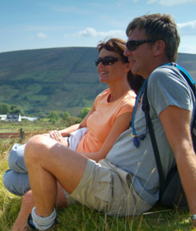
The remoteness of the Sperrins, of course, is part of their modern-day charm. The entire region has a sparse population of some 150,000 - and therein lies one reason for its tranquillity. On a long day’s march - or on a National Geographic drive — you’re unlikely to meet hiking or biking hordes.
In fact you’ll be lucky to meet anyone at all. Take the Dun Ruadh tombs and stone circle that are situated on the sweeping curve of Crockyneill on the A505 (part of our recommended route).
Dun Ruadh, built some 4,000 years ago, is a complex series of stone structures. Beyond Dun Ruadh, further up the hill, another monument is hidden well away from view.
This is a mass stone built sometime in the 19th century so that the oppressed Faithful could worship in safety. Access to this evocative location is through a farm, and despite the sign saying “Be aware of the dog” (which put like that sounds more of a philosophical observation than a warning), the family that live there are very friendly. I asked if they were busy, this being summer. “Oh aye, right and busy. We’ve had at least half a dozen people this week.”
Perhaps it’s odd that this region isn’t more populated. Because, as you stand on a windswept bog in the heart of the region, the wind howling across the ancient rocks, somehow it's not difficult to believe that some of the oldest known human-made constructions in Europe are scattered throughout this landscape.
Homo sapiens hibernicus was alive and well in this part of Norn Iron just after the Ice Age — some six to seven thousand years ago, and their culture was already ancient by the time the Celts arrived, if indeed they did arrive (archeaological opinion is divided, but more of that another day).
Musing set aside for the moment, from Dun Ruadh we head back north towards the peak of Spaltindoagh, then it’s eastwards along the banks of the Glenelly River, with the Sperrins rising gently to our left.
This valley was carved by the glacial flows of the Ice Age, and to be truthful not a lot seems to have happened since then. Bodoney church was built in the mid-18th century, on the site of former monastery - a prior Priory as it were - and before that our busybody ancestors were building tombs at Glenroan and Clogherny some 4,000 years ago. But that seems to be about it.
You should probably stop and ruminate. The National Geographic would probably recommend it, to be honest. They’re into all this sort of stuff, and would agree that the building of tombs is an important step forward in the development of Mankind - building shelters is one thing, but when you start burying your dead, then you've got yourself a rudimentary culture; you've separated yourself from other species. A tomb is a significant thing - it indicates respect for the dead and a real attachment to ancestors.
Evidently amongst these early people there was a need, continuing across the millennia to the present day, to visit the dead and attempt to communicate with we-know-not-what. And evidently they’ve been doing it here in this corner of the Six Counties for the thick end of five thousand years.
We’re still heading east now - and soon reach Barnes Gap, which cuts through the east-west crest line of the southern Sperrin Mountains ridge, between the hills of Mullaghbane and Mullaghbolig. From here it’s northwards through the Sperrins, with the highest peak in the range, Mount Sawel, to the left.
Our round then takes a sweep round the eastern Sperrins, past the town of Moneymeany, before heading westwards once again, and following the Owenkillew River, and heading in the general direction of Omagh.
Needless to say, you don’t need to confine yourself to the car. The Gold Cycle Route (31 miles in length) begins in Gortin and is marked with brown Route 1 signs.
The first part of the route takes you into the Glenelly Valley. Speed your way up to the wilds of Sawelabeg and Doraville, past a gold mine opposite the bridge at Glenlark, and finally follow the Owenkillew Valley back into Gortin.
En route you pass the Sperrin Heritage Centre (028 8164 8142, www.strabanedc.com) where you can find out all about the geology of this stunning region and pick up maps with suggested hiking routes, nature trails and bridle paths. You might even meet Murphy, the centre's resident ghost.
The Sperrins, designated an Area of Outstanding Beauty, are threaded with mountainous valleys, streams, forests and shady glens, trails, tracks and quiet laneways. With its rich cultural heritage etched on the landscape, this is the perfect place to explore on foot.
The sights of The Sperrins
Gortin Glen Forest Park, six miles north of Omagh, is the western gateway to the Sperrin Mountains. Traces of the ancient oak forest that once covered Ireland are still visible, but today the woodland is mainly coniferous, planted originally for timber production.
But there’s enough open heathland to make this a very attractive estate – from here you can spot the Blue Stack Mountains in Donegal, away to the west. In the spring and early summer the air rings with the sound of the cuckoo.
The forest has a five-mile long drive with breath-taking views across the Tyrone landscape. A number of stopping off points do the job perfectly.
The park also has hiking routes, horse-riding trails and three mountain biking routes threading through the northern section of the forest above the Glenpark Road.
All trails provide excellent views of the Plain of Omagh, Mullaghcarn Mountain and Bessy Bell Mountain. En route you’ll see red squirrels, deer, buzzards and other raptors.
On the last Sunday of July (called Cairn Sunday), hundreds of people make a pilgrimage to the top of Mullaghcarn as part of an ancient tradition.
For further elucidation on Tyrone's culture, stop off at An Creagan (Creggan) Visitor Centre on the main Cookstown to Omagh Road, about three miles from Drumlister (Tel: 0298 807 61112).
Within a five mile radius of An Creagan stand some 44 prehistoric monuments some dating back 6,000 years - give or take six months or so. The people who built these intricate structures would have regarded the Pyramids as new-fangled.
To get a grip on the history of the area, halfway between Omagh town and Newtownstewart you'll find the Ulster American Folk Park, which tells the story of emigration to the New World. From Omagh to Omaha, as it were.
The park is centred round the restored farmhouse of Thomas Mellon who left Tyrone in 1818 and eventually founded the Mellon Bank of Pittsburgh. Even by Tyrone standards that's going some.
The folk park boasts, amongst many other exhibits, a beautifully restored weaver’s cottage, a local schoolhouse and a blacksmith’s forge. The New World area consists of several type of log cabins, a Conestoga wagon (a “prairie schooner”), and of course a complete list of the US presidents who had connections with the North (over a dozen of ‘em). Costumed demonstrators go about their everyday tasks including spinning, open hearth cookery, printing and blacksmithing.
The centre also has the restored cottage of John Joseph Hughes from Augher, who became the first Catholic Archbishop of New York, responsible for building St Patrick’s Cathedral in the city.
Around this simple cottage, a 200-year-old village has been meticulously reconstructed. An antiquated shopping street leads to an emigrant sailing ship, and on to a New World homestead — a cluster of log cabins, surrounded by fields of maize. It's a dramatic recreation of the life these emigrants made when they reached America, and the life they left behind.
Creggandeveskey Court tomb is a well preserved court tomb just over two miles north east of Carrickmore — itself a town worth a visit just to see the impressive republican memorial.
Many of the prehistoric graves found in Ireland, such as Creggandeveskey, indicate they were built to accommodate ritual alongside, or perhaps inside, the graves. The actual nature of these rituals is obscure, but may resemble practices observed until recently amongst isolated tribes in various parts of the world - journeying to the ancestral graves, taking out the corpses (or remaining bones) dressing them up in clothes and partying right on down there!
Knockmany Passage Grave, or Annia's Cove, is about a mile north west of Augher (near Clogher if you happen to be on a rhyming tour of Ireland) and on the summit of Knockmany at the top of the Forest Park (another good walk). The Cairn at the top gives you a spectacular view across the Clogher valley.
However ancient Irish man may not have been universally benign. It seems that when any structure was built a sacrifice was made, possibly to compensate the gods for any interference caused in the unity of the earth. A wide range of victims seem to have been pressed into service, including sheep, hares and humans.
The humans are usually what we would call middle-aged men (40 plus) but of course back in Ancient Ireland this may have been regarded as a ripe old age, and ready for culling. You can just imagine an ancient Neolithic parent saying to his disgruntled children, "Huh! After the sacrifices I've made..."
